


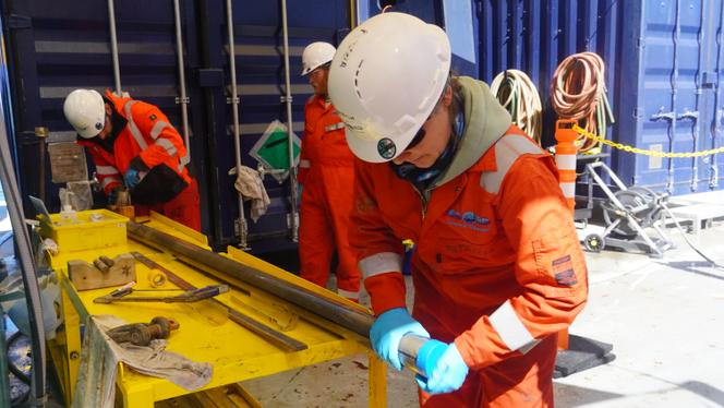
It was 3 am. 35 kilometers Southwest of the coast of Nantucket Island, off New England, the foredeck of the specialized vessel L/B-Robert was bustling with activity. Unbothered by engine noise and the rain that had just started to fall, the night crew worked under the glare of floodlights, maneuvering through a maze of containers behind which, six or seven meters high, a drilling tower could be seen.
Wearing hard hats and worksite gear, personnel cut the plastic tubes containing the cores, which had just been brought up from the ocean floor, into 1.5-meter sections. Technicians measured and catalogued these cores and extracted sediment and water samples for geochemists to analyze or preserve. Meanwhile, in a laboratory container nearby, specialists scanned the cores section by section, sliding them under a device equipped with multiple sensors.
Density, natural radioactivity, acoustic, electric and magnetic properties, and more: All this data, together with a basic description of whether the material was sandy or clay, would be used to create a preliminary stratigraphy of the site. This would help the team get their bearings and move toward their goal: "To find freshwater," explained Erwan Le Ber, a postdoctoral researcher at the University of Leicester in the United Kingdom who was responsible for petrophysics operations and organized this nighttime visit remotely by video.
You have 79.37% of this article left to read. The rest is for subscribers only.