


Since the start of Israeli operations in the Gaza Strip, which were launched after the shock of Hamas's massacres on October 7, 2023, the international media has been unable to enter the enclave – with the exception of rare, short trips, under the Israeli army's strict supervision.
The massive bombing campaign and the ground offensive that has been conducted since October 27, 2023, have had a devastating impact on the Gaza Strip's dense urban areas. Being unable to directly measure the extent of the devastation on the ground, Le Monde's Infographics desk used two types of sources to chart the destruction.
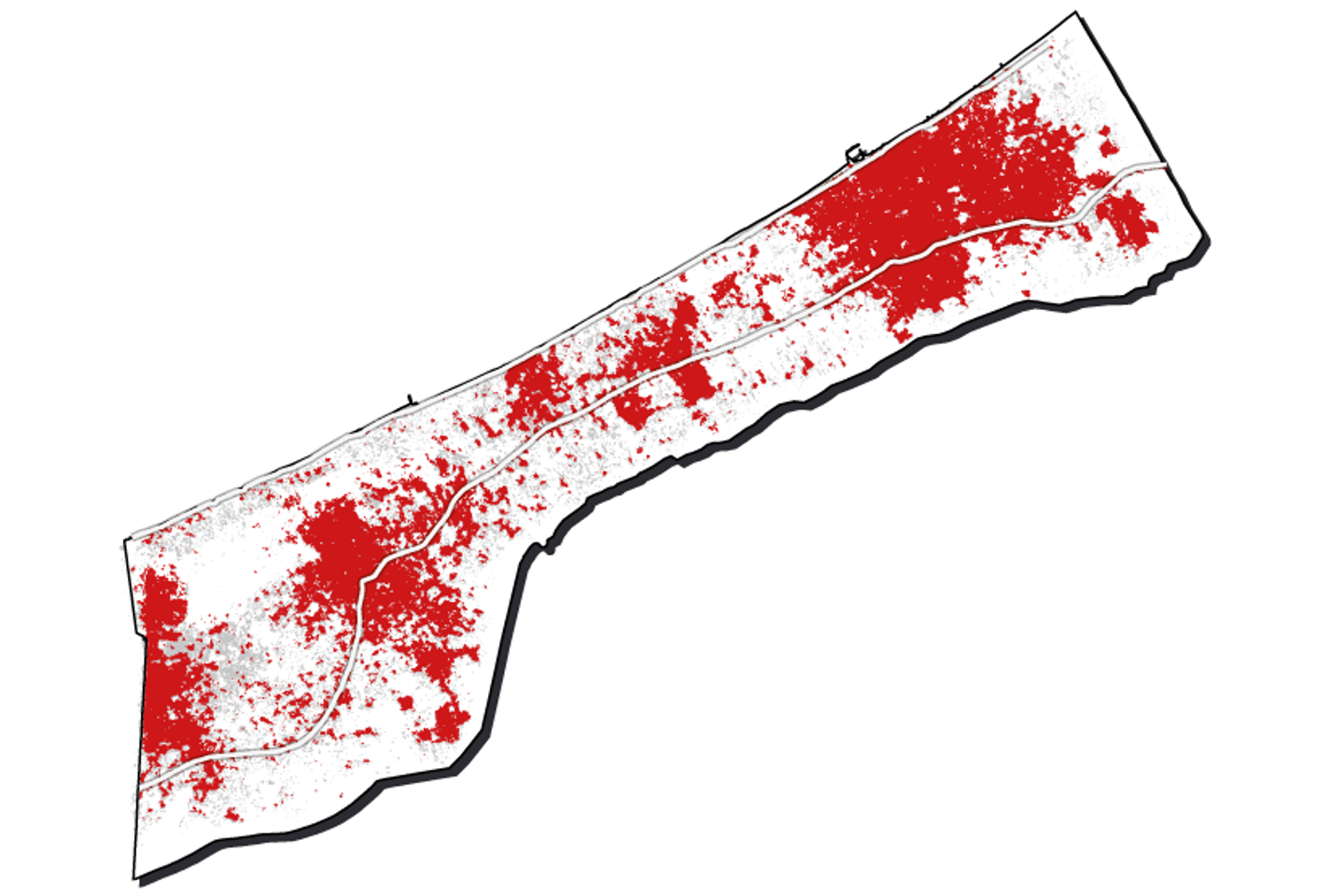
First, testimonies, videos and photos taken by journalists and Palestinian civilians trapped on site. They document entire neighborhoods disappearing under the rubble. Second, satellite images produced by both public satellite constellations (European Space Agency, NASA, etc.) and those belonging to private stakeholders (Maxar, Planet Labs, etc.). Using these images, two US-based researchers – Corey Scher, a PhD student in earth and environmental sciences specializing in natural disasters and political conflicts at the City University of New York's (CUNY) Graduate Center, and Jamon Van Den Hoek, an associate professor of geography at Oregon State University – have been tracking the destruction in the Gaza Strip over the past year.
VIDEO GOES HERE
The researchers produced these maps by analyzing data collected by the Copernicus Sentinel-1 SAR (Synthetic-Aperture Radar) satellites, a joint initiative of the European Commission and the European Space Agency (ESA), with a resolution of 10 meters per pixel. SAR satellites provide the advantage of collecting information day and night, no matter the weather conditions (cloud cover, lack of lighting, etc.). Being unable to verify the satellite data in the field, they then cross-referenced it with assessments published by UNOSAT, the United Nations satellite center, as well as with very high-resolution commercial satellite images, which can go up to 30 centimeters per pixel.
This enables the creation of fine-detail maps of the likely damage inflicted on human constructions across the Gaza Strip, as their methodology does not apply to potential damage in areas with high levels of vegetation (agricultural regions, natural areas, etc.). As they state in their methodology, "given the likely presence of very small-scale damage that we are unable to detect using Sentinel-1 data with 10-meter resolution pixels, the damage maps likely offer a conservative estimate for areas affected by building damage."
You have 31.58% of this article left to read. The rest is for subscribers only.