


Mayotte: Before and after pictures show devastation after cyclone Chido
GallerySatellite photographs taken by the American company Maxar on Monday, December 16, show an unprecedented level of devastation in the French territory in the Indian Ocean following the cyclone's passage.
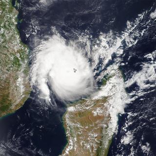
Four days after tropical cyclone Chido hit Mayotte on Saturday, December 14, the French government is still unable to estimate the human toll on the overseas territory in the Indian Ocean, but fears deaths could reach the hundreds.
Through Agence France-Presse, space technology company Maxar has released satellite images taken on Monday, December 16, over the French overseas department. The images show a frightening level of destruction to buildings and road infrastructure.
In Mamoudzou, the capital of Mayotte and main town on the island of Grande-Terre, most buildings failed to withstand the devastating winds, measured by Météo-France at over 180 km/h, with gusts approaching 250 km/h in the north of the island.
The industrial zones to the north of the city, made up of "hard" buildings, held up better, but still suffered significant damage.
The marina on the east coast, along Route Nationale No. 2, was completely swept away by the storm and the resulting marine submersion.
On the island of Petite-Terre, which includes the towns of Dzaoudzi and Pamandzi, to the east of the main island of Grande-Terre, damage was also considerable. It was this part of the department that the cyclone hit first.
Like the rest of the commune, the port of Dzaoudzi was hit by the cyclone, with its quays partly destroyed.


The Interior Ministry currently estimates that 70% of Mayotte's inhabitants have been "seriously affected" by the cyclone. The emergency service of the European Copernicus program estimates, based on satellite images, that over 19,000 buildings and 105 km of roads have been damaged or destroyed.