


A taste of summer, but also of France being rocked by climate change. On Saturday, April 6, mainland France will experience a brief but exceptional peak in temperatures, which are forecast to reach or even exceed 30°C in the southwest, and 25°C in the northern half of the country. "That's around 10 degrees above normal. It's very rare to reach such levels so early in April," said Tristan Amm, a weather forecaster at France's national weather service, Météo-France. The 30°C mark is normally reached sometime between mid-May and the end of June in mainland France.
However, as a result of global warming, heat thresholds are reached increasingly early in the spring – and remain high later into the fall. As a result, summer is becoming more dominant over the other seasons than ever before.
More specifically, after a rise in temperatures on Friday, the 30°C mark could be reached on Saturday in the southern part of central France; and even exceeded in the southwestern, with temperatures reaching as high as 31 to 32°C in some places. Those last two areas could even experience "tropical nights" on Friday and Saturday, when temperatures don't drop below 20°C. During the day, temperatures are also predicted to reach 25 to 29°C in the Loire region, and 26 to 28°C in the greater Paris area, as well as in the East. Very few areas will be spared from the heat wave.
The national heat indicator, which tracks the average daily temperatures measured at 30 stations across mainland France, is expected to reach between 17 and 18°C on Saturday – a record for early April. However, according to Météo-France, this episode does not qualify as a heat wave because there are specific criteria to be met, in particular a temperature of 25.3°C or higher for one day.
Foehn wind
What explains this early surge in temperatures? "A low-pressure system off the Atlantic acts like a heat pump, bringing warm air from Africa to France," explained Amm. "This is a classic configuration, but with global warming, it's bringing about higher temperatures than in the past," explained Aurélien Ribes, a climatologist at the National Center for Meteorological Research (CRNM). This hot spell has been locally reinforced, particularly near the Pyrenees, by what is known as the "Foehn effect." "The southerly wind, after having crossed the Pyrenees, will come down on the ground on the French side. This compresses the air mass and heats it up," added Amm.
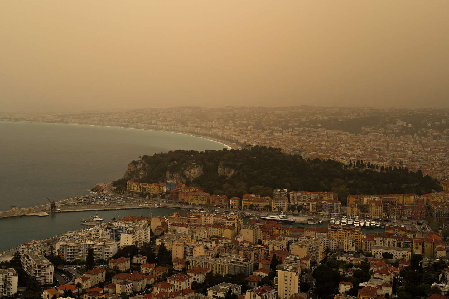
By contrast, the cloud of sand from the Sahara, which will blanket France this weekend and tint the skies orange, is unlikely to lower temperatures, according to the forecaster. It will act as a filter limiting the sun's rays and will mostly affect France's north-west, which is already set to be spared from the peak in temperatures. The sand cloud will degrade air quality across the country, with possible health repercussions.
You have 32.42% of this article left to read. The rest is for subscribers only.