
In the event of a disaster, a mobile phone may be the first to alert someone.
With Wireless Emergency Alerts (WEAs), customers of telecommunications companies including Verizon, T-Mobile and AT&T receive urgent messages from government agencies during critical situations such as tornadoes, flash floods or AMBER Alerts. FEMA said the messages show the type and time of the alert, any action people in the impacted area should take, and the agency issuing the alert.
WEAs are issued by authorized federal, state, local, tribal and territorial public alerting authorities and broadcast from cell towers to any WEA‐enabled mobile device in a locally targeted area. WEA is part of a partnership between FEMA, the Federal Communications Commission (FCC) and wireless providers, aimed at enhancing public safety.
There are different types of alerts, but natural disasters and extreme weather fall under the Imminent Threat Alerts category.
Wireless Emergency Alerts are not subscription-based, according to FEMA. There is also no need to provide personal information to receive a WEA. WEAs are free and based on location. However, people will still receive messages even if they are in an area where they don't live or are outside the area where the phone is registered.

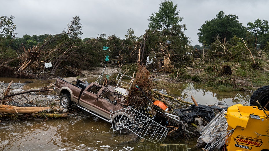
Flood waters left debris, including vehicles and equipment, scattered in Louise Hays Park on July 5, 2025, in Kerrville, Texas. (Eric Vryn / Getty Images)
If someone travels into an area after a WEA was sent, they will receive the message, if the alert is still active.
To identify if it's an WEA, FEMA said the alert will be no more than 360 characters. These messages will also have a specific tone and vibration that will be repeated twice.
Wireless providers are selling devices with WEA capability included. However, to find out if a phone can receive WEA alerts, FEMA said people should contact their wireless provider, which participates in WEA on a voluntary basis.
Wireless Emergency Alerts (WEAs) do not track people's location. Instead, they’re broadcast from cell towers to all WEA-enabled phones in a specific geographic area.

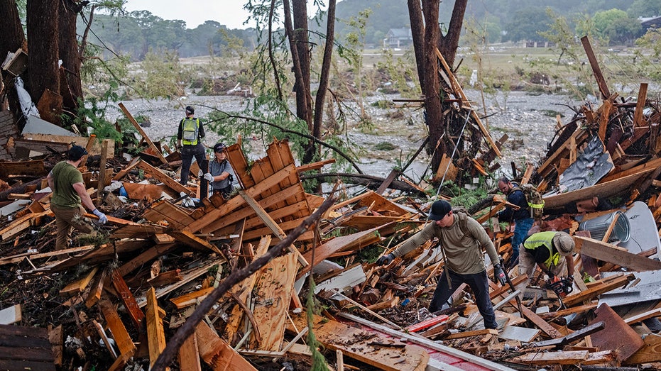
Search and rescue workers dig through debris looking for any survivors or remains of people swept up in the flash flooding on July 6, 2025, in Hunt, Texas. (Jim Vondruska / Getty Images)
If a phone is in range, a person will receive the alert no matter which carrier they use. If someone is on a call when an alert is sent, it will be delayed until the call ends. WEAs are also not affected by network congestion, so they can get through even when regular calls or texts are slow.
Aside from the WEAs, the National Weather Service also sends up repeated warnings.
On July 3, ahead of the deadly flooding in Central Texas, the NWS offices in Austin and San Antonio conducted forecast briefings for emergency management in the morning and issued a Flood Watch in the early afternoon. Flash Flood Warnings were issued on the morning of July 4, giving preliminary lead times of more than three hours before warning criteria were met.
First, the National Water Center Flood Hazard Outlook issued on July 3 indicated an expansion of flash flood potential to include Kerrville, Texas, and surrounding areas. A Flood Watch was then issued by NWS Austin and San Antonio around 1:18 p.m. central time Thursday, in effect through Friday morning.
The Weather Prediction Center (WPC) also issued three Mesoscale Precipitation Discussions for the excessive rainfall event as early as 6:10 p.m. Thursday, indicating the potential for flash flooding.
The National Water Center Area Hydrologic Discussion (AHD) #144 messaged locally considerable flood wording for areas north and west of San Antonio, including the city of Kerrville, and the first Flash Flood Warning for the event was issued at 11:41 p.m. Thursday for Bandera County. The AHD is a tool to help the NWS quickly identify and communicate potential flash flood threats.

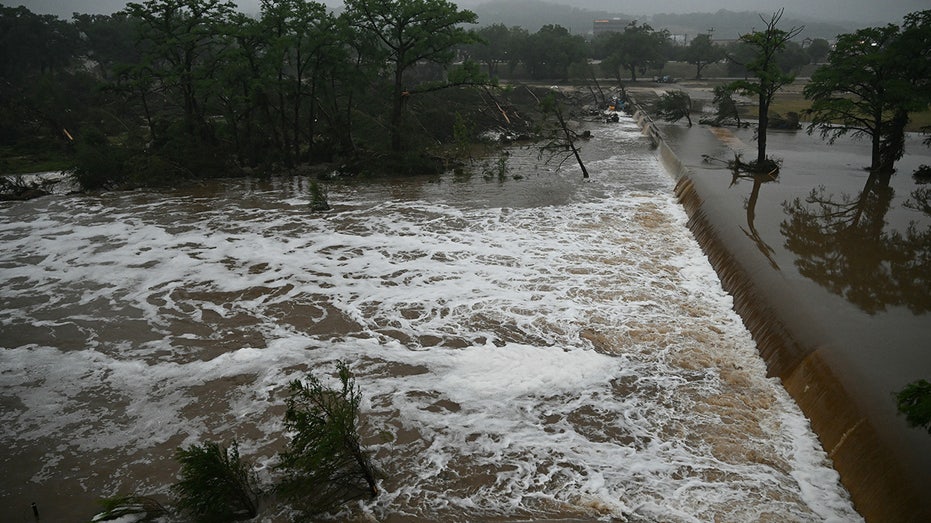
A photo shows flooding caused by a flash flood at the Guadalupe River in Kerrville, Texas, on July 5, 2025. (Ronaldo Schemidt/AFP via / Getty Images)
At 1:14 a.m. Friday, a Flash Flood Warning marked as "considerable" was issued for Bandera and Kerr counties, signaling a serious threat. Warnings labeled "considerable" or "catastrophic" mean there’s a high risk of major damage. These alerts automatically go out as emergency notifications to cellphones in the area and are also broadcast over NOAA Weather Radio, ensuring the public is warned during only the most dangerous flash flood events.
The NWS said the first reports from Kerr County Sheriff's Office of flooding at low water crossings had 201 minutes of lead time. However, just after 4 a.m. local time, the Flash Flood Warning was upgraded to a Flash Flood Emergency for south-central Kerr County, including Hunt.
An hour later, the National Water Center Area Hydrologic Discussion #146 included concern about considerable widespread flooding throughout the day. The Flood Hazard Outlook was also upgraded to considerable and catastrophic.
A Flash Flood Emergency was issued for the Guadalupe River at 5:34 a.m.
