


MIAMI — Tropical Storm Jerry churned Thursday in the Atlantic on its approach to the Leeward Islands as Tropical Storm Priscilla moved along Mexico’s Pacific coast, threatening heavy rain and flooding in their paths, forecasters said.
Priscilla could bring flash flooding through the weekend across the U.S. Southwest, the U.S. National Hurricane Center in Miami said.
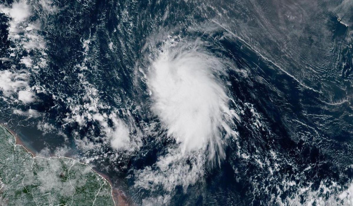
Jerry was centered about 355 miles (571 kilometers) east-southeast of the northern Leeward Islands and moving west-northwest at 20 mph (32 kph) with maximum sustained winds of 65 mph (105 kph), the center said.
The storm was expected to pass near or to the northeast of the northern Leeward Islands on Thursday night.
In the Pacific, Priscilla was centered about 295 miles (475 kilometers) west of the southern tip of Baja California and moving northwest at 8 mph (13 kph) with maximum sustained winds of about 50 mph (80 kph).
Priscilla was bringing high surf and gusty winds to Baja California Sur, which was under a tropical storm watch from Cabo San Lucas to Cabo San Lazaro. The storm had approached major hurricane status Tuesday before weakening to a tropical storm on Wednesday.
In the Atlantic, Jerry was expected to strengthen gradually and could become a hurricane by late Friday or Saturday. On Thursday into early Friday, up to 6 inches (15 centimeters) of rain could fall across the Leeward Islands, forecasters said.
A tropical storm watch was in effect for Antigua, Barbuda and Anguilla, St. Kitts, Nevis and Montserrat, St. Barts and St. Martin, Saba and St. Eustatius and Guadeloupe and the adjacent islands, the center said.
A third storm, Octave, weakened Wednesday evening in the Pacific but remained a tropical storm early Thursday. The storm did not threaten land and was likely to dissipate Thursday, forecasters said.
Octave was located about 430 miles (692 kilometers) south-southwest of the southern tip of Baja California and moving east-northeast at 18 mph (29 kph) with maximum sustained winds of 40 mph (64 kph), the center said.