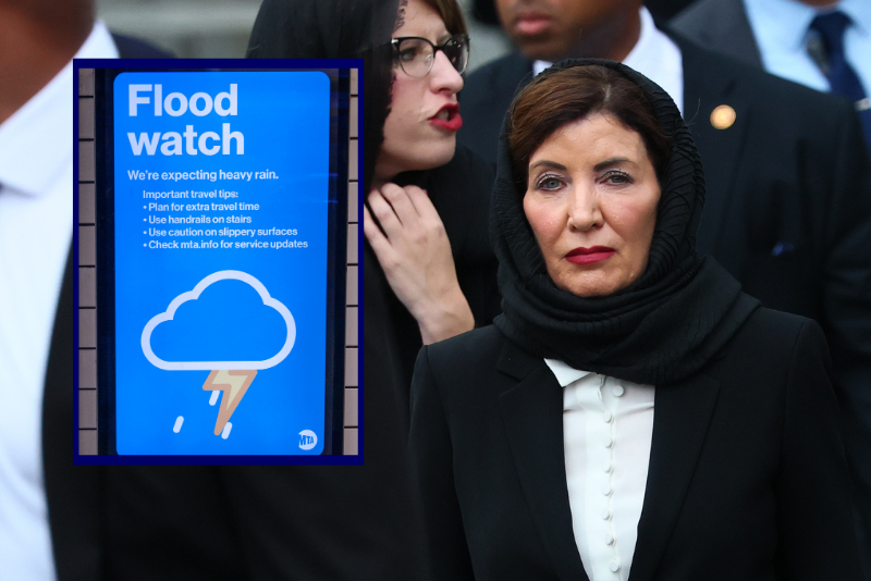
(R) A flood watch warning inside 28 Street Subway station on July 31, 2025 in New York City. Widespread storms swept across the Mid-Atlantic and Northeast on Thursday, bringing bursts of heavy rain. (Photo by Adam Gray/Getty Images) / (Background) New York Gov. Kathy Hochul on July 31, 2025. (Photo by Michael M. Santiago/Getty Images)
OAN Staff Brooke Mallory 11:52 AM – Thursday, July 31, 2025
New York Democrat Governor Kathy Hochul declared a state of emergency on Thursday, citing heavy rainfall and a heightened risk of life‑threatening flash flooding across New York City, Long Island, the Hudson Valley, and multiple surrounding counties.
“I am urging all New Yorkers to stay vigilant, stay informed, and use caution as we expect excessive rainfall with the potential for flash flooding,” Hochul said. “State agencies are on standby for heavy downpours and localized flooding and will be monitoring the situation in real-time to ensure the safety of all New Yorkers in the path of the storm.”
Torrential rain slammed the East Coast, flooding highways, halting NYC train service, and grounding flights from Philly to New York. Emergency crews rescued trapped drivers as more storms are expected tonight.
The state of emergency includes New York City, Long Island, the Hudson Valley, and counties such as Bronx, Kings, Queens, Nassau, Suffolk, Westchester, Rockland, Dutchess, Orange, Putnam, Sullivan, Ulster, and Delaware.
Meteorologists had forecasted intense rainfall, potentially reaching up to 3 inches per hour, in addition to isolated areas expecting to receive as much as 5-to-8 inches in total.
New York City officials issued warnings that the heavy flooding could inundate roadways, submerge portions of the subway system, and flood basement-level residences. Residents living in basement apartments have been advised to relocate to higher floors, and a travel advisory was issued urging New Yorkers to limit movement from Thursday afternoon through Friday afternoon.
The Clearview Expressway, a busy highway in the borough of Queens, was shut down in both directions due to flooding. According to a law enforcement source speaking to CNN, at least two vehicles were submerged on the roadway.
Meanwhile, commuter rail service to suburban Long Island was suspended on one of its busiest lines during the evening rush hour, further compounding the disruption.
In Pennsylvania, the National Weather Service also issued alerts anticipating rainfall rates of up to 3 inches per hour, which subsequently led to urban flooding in the city of Reading. One widely circulated video captured water cascading down a city street, submerging vehicles up to their mid-doors and rendering a heavily trafficked commercial intersection nearly impassable.
In Maryland, particularly in areas north of Baltimore, emergency responders carried out multiple water rescues as flash flooding impacted residential and roadway infrastructure.
Major airports across the Northeast, including those in New York, New Jersey, Washington, D.C., and Philadelphia, experienced widespread weather-related disruptions, with numerous flight delays and cancellations reported due to the severe conditions.
I will be declaring a State of Emergency for New York City and the surrounding counties.
Heavy rain and potential flooding are expected to affect the evening commute. Employers are encouraged to dismiss employees early.
Continue to monitor your local forecasts, and stay safe.
— Governor Kathy Hochul (@GovKathyHochul) July 31, 2025
Tahesha Way, the acting governor of New Jersey, had also proclaimed a state of emergency for the state earlier, taking effect at 2:00 p.m. on Thursday, in anticipation of the extreme weather.
“Beginning this afternoon, we are expecting severe thunderstorms to bring heavy rainfall and damaging wind gusts with the potential for flash flooding across the state,” said Way. “I urge all New Jerseyans to remain alert, follow all safety protocols, and monitor the proper channels for the duration of these storms. Residents should remain off the roads and indoors unless absolutely necessary.”
The combination of an already saturated ground and heavy downpours are significantly increasing the risk of dangerous conditions, including flash floods, rockslides, and landslides, according to officials. They have warned that travel may become hazardous, particularly during the evening commute, when the heaviest rainfall is expected.
Storms are also likely to persist well into the night.
Washington, D.C., and Baltimore are expected to receive some of the most intense rainfall, with flash flood warnings in effect through the evening. A severe thunderstorm watch remains in place until 8 p.m. for a broad area that includes Washington, Baltimore, Philadelphia, and New York City.
New York City has issued a travel advisory for Thursday and Friday, and a flood watch is in effect on Thursday afternoon.
New Yorkers, be prepared for a serious storm to arrive later this afternoon. A Flood Watch begins at 2 PM, and we've issued a Travel Advisory for today and tomorrow.