


A double-plume blast from the Continent is about to plunge Britain into a 30C-plus heatwave.
A shift in the jet stream will pull in a surge of southerly warmth this week as the UK braces for the hottest day of the year.
Temperatures will dip at the end of the week before another fireblast at the weekend, forecasters say.
Southern regions will be in the firing line for the full force of the heat, although temperatures nationwide will rocket.
Jim Dale, meteorologist for British Weather Services, said: “We are going to be looking at temperatures around 32C from the middle to end of the week, and at the weekend.
“When the heat arrives depends on low pressure to the west, and there is a battle of wills going on.
“But, with very warm air coming up from the south, we should be seeing the hottest period of the year so far.”
Britain’s weather is under the influence of tussling pressure systems, with the heat threatening to bring rain and thunder.

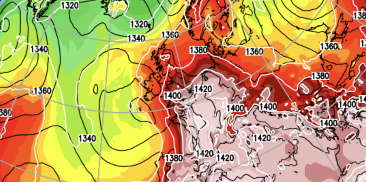
Hot plume moves in from the south
Netweather
Depending on how fast these low-pressure cells move across the country will dictate when the heat arrives.
The most likely outcome is a blast of hot weather towards the middle to end of the week, and another at the weekend.
Netweather’s Nick Finnis said: “A plume of very warm air will push north across England and Wales from mid-week, relaxing on Thursday before a second even warmer plume perhaps arrives Friday or Saturday.”
But with higher temperatures will come instability and the threat of torrential rain and thunder, typical of Spanish Plumes.
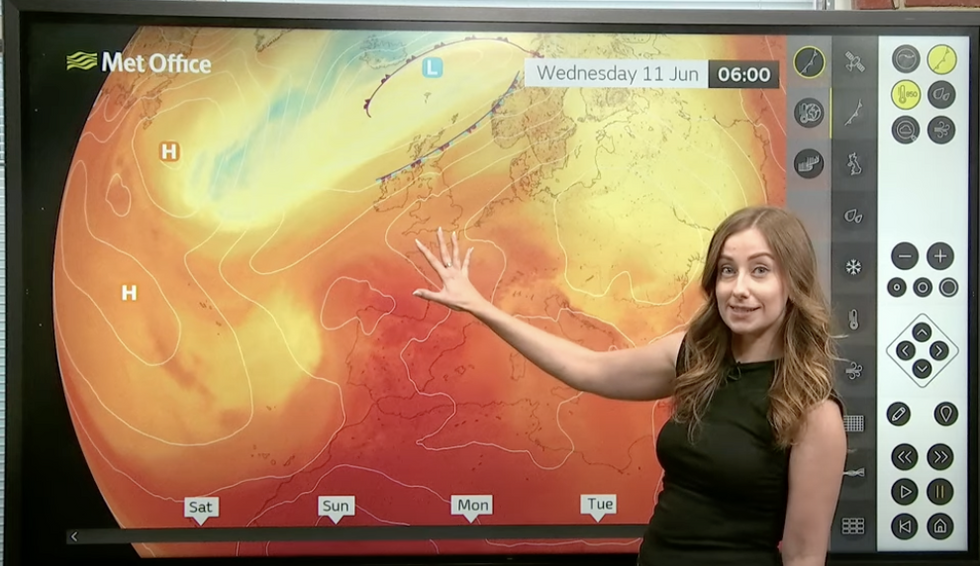
Met Office’s Honor Criswick describes hot air coming into Britain
MET OFFICE
Met Office meteorologist Honor Criswick said: “By the time we reach Wednesday and Thursday, a lot of warm air across Iberia and moving up into the Bay of Biscay is pushing up towards the south.
“So, a lot of that is reaching southern UK, perhaps further north, depending on where an area of low pressure sits, so from the middle part of the week, temperatures are on the way up, but it is hard to pinpoint where that warm plume is going to go.
“And with that warm, humid air, it is likely to result in a thundery breakdown, so it is turning warmer with a good chance of thunderstorms.”
Meanwhile, the next couple of days paint a drearily familiar picture of sunshine and showers.AccuWeather’s lead international forecaster, Jason Nicholls, said: “Tuesday will bring a blend of sunny spells and showers, and these will be most frequent to the north of the country.
“Again, on Wednesday, it is a picture of sunny periods and isolated showers and towards the end of the week, there will be a greater risk of thunderstorms.”