


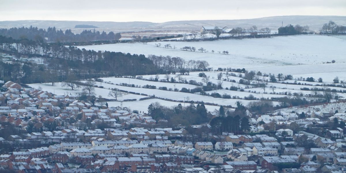
The latest weather forecast showed that parts of the UK could be in for a wave of snow just hours before Christmas.
An Icelandic cold snap is set to hit the UK with temperatures set to plunge below -10C.
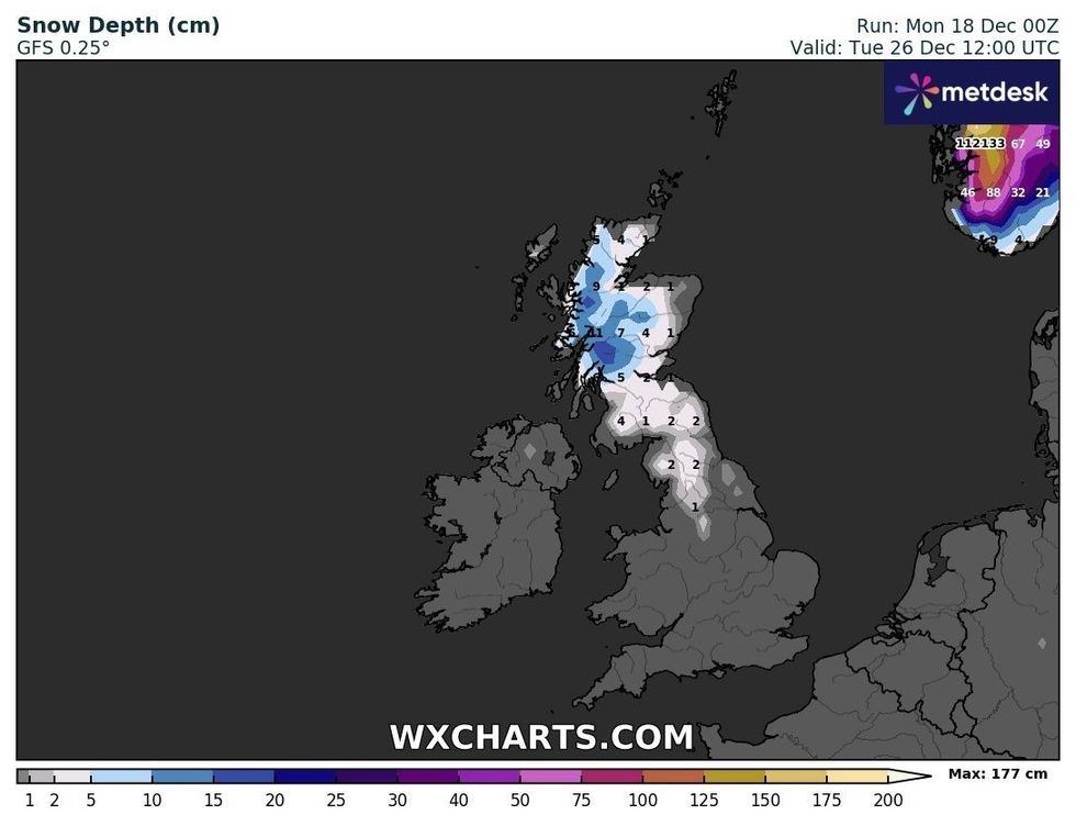
According to forecaster WXCharts, snow is expected to arrive in Scotland early on Saturday 23 December.
However, snow could come down to northern parts of England on Christmas Eve.
The latest forecast says that as much as 9.5 inches (24cm) could accumulate in the most affected areas, and the maps suggest there will be plenty on the ground on Christmas Day.
Aside from the snow, some hilly areas in the far north could wake up to lows of -10C on Christmas Day.
However, forecasters from the Met Office are predicting a wetter festive period, with periods of uncertainty.
There could be moments of wind and high pressure moving further south towards the end of next week.
UK snow: Britain tipped for 9-inch white blanket amid -10C Icelandic cold snap
WX Charts
A spokesperson from the Met Office said: "As we head towards the end of next week and the festive period there is, as always, more uncertainty in the forecast.
"However, there are indications that by the end of next week we could see high pressure moving further south and west away from the UK, allowing northwesterly winds to develop at times.
"This would allow some short periods where colder air affects the UK, with the potential for wintry showers in northern areas.
"At this stage there is very little sign of any widespread or severe cold and wintry weather."
Met Office chief meteorologist, Matthew Lehnert, added: "This weather front will move slowly south and bring some rain to the remainder of the UK.
"As the front clears south, temperatures will return to near average.
"It will remain changeable through midweek, with the best of any prolonged drier spells in the south and east."