


In today’s age where the smart-phone is king in all things like Uber and Waymo, and getting driving directions to a new restaurant for dinner in an unknown city, GPS (Global Positioning System) for PNT (Position, Navigation and Timing) is a lifesaver. But what happens when GPS does not work - like in major urban areas (urban canyons), tunnels and caves where GPS satellite signals are hard to receive (a minimum of 4 different satellite signals are required to accurately determine position). Or when drones or airplanes lose GPS connectivity due to jamming by adversaries, or loss of satellite signal ? Underwater navigation presents another problem (wireless radio frequency signals used by GPS do not work). This is a serious problem impacting safety, productivity and security, and creates significant mission risks in military operations. GPS denial generally comes with loss of communications which makes it impossible to receive remote guidance.
There are alternate solutions. Mechanical IMU (Inertial Measurement Units) sensors measure acceleration and angular velocity, and enable dead reckoning from a known initial point to the destination. However, they accumulate errors and have limited operation time before requiring re-calibration to a GPS or another localization source. Visual sensors like LiDAR (Light Detection and Ranging) and cameras can identify landmarks and reference them to a known map to provide localization capabilities (< 30 m accuracy). These are used by autonomous vehicle ride-hailing companies like Waymo in urban areas with a lot of tall skyscrapers (and compromised GPS). RF (radio frequency) signals can also be used to localize (<500 m accuracy). Celestial navigation by using star locations is another method for localization (< 2000 m accuracy). But these have their own problems like error accumulation, poor localization in bad weather (cameras and LiDAR), clody skies (celestial navigation) or lack of covertness (RF and LiDAR) which can point adversaries to the source and allow jamming/spoofing of signals and communications.
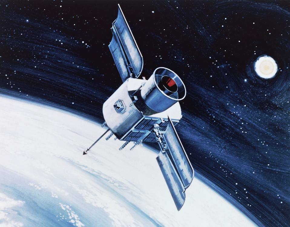
The first GPS satellite (Navstar 1) was launched in 1978, primarily a result of DARPA’s (Defense Advanced Research Projects Agency) pioneering initiatives in 1960. By 1993, the GPS Block IIA satellite constellation was completed (24 satellites). Since then, there have been continuous efforts to improve the performance (accuracy) and anti-jamming resilience of the GPS satellite network are underway. Congress approved development of next-generation GPS systems (GPS Block III) in 2000. Boeing (which developed and managed the previous generation, GPS Block II) and Lockheed Martin were the major defense primes that competed for the contract. After a series of proposals and demonstrations, Lockheed was awarded the contract in 2007. The first of 10 GPS III satellites was launched in 2018. Currently, a total of 8 are in orbit, with the last 2 projected to launch by 2026. The key aspects of these satellites include higher accuracy (from 5-10 m to 1-3 m), higher transmit power (enabling lower interference) and very importantly, hardened anti-jamming capability through a combination of encryption codes and higher signal power using directional (or spot antennas). This signal, called the M-code, enhances anti-jamming capabilities by an order of magnitude. It is also designed to be backward compatible across the previous generation (GPS Block II and prior generations) of satellites (23 satellites).

Beyond this, the next generation (Block IIIF) satellites are in production (2 being currently built, with an option for 10 more). This will elevate anti-jam/anti-spoof capabilities in contested environments by 60X over Block II. It is worth noting that GPS satellites are completely reliant on quantum-based atomic clocks for accurate timing information (used for positioning) and also for various other activities on Earth like energy control, financial systems, etc.
According to Malik Musawwir, vice president of Navigation Systems for Lockheed Martin Space. “GPS is one of the most resilient technologies ever deployed, trusted daily by more than six billion people worldwide. Each generation of these spacecraft have revolutionary capabilities designed to combat emerging threats and withstand the harshest conditions – from nuclear detonation effects to space radiation, in the highest threat environments. We continue strengthening GPS resiliency with each system build, delivery and launch."
Founded in 2016 by ex-NASA engineers, the company focuses on using 1550 nm Doppler LiDAR (Light Detection and Ranging) for spacecraft landing and navigation. As opposed to ToF (Time-of-Flight) LiDAR which emits nanosecond laser pulses, detects reflections from targets and uses launch-to-detect timing to compute 3D range, Doppler LiDAR uses FMCW (Frequency Modulated Continuous Wave) coherent laser signals, and mixes the reflected signal with a reference local signal (transmitted signal) to extract both position and relative axial velocity simultaneously. This is optically similar to the familiar Doppler effect associated with ambulance or police sirens (high pitch or acoustic frequency at short range, vs lower pitch and frequency at long ranges). Psionic completed its Series A fund-raise in 2024, currently has 55 people and is profitable. It is currently preparing for a Series B raise.
The technology was initially developed at NASA , and forms the cornerstone of the Psionic Space Navigation Doppler LiDAR (PSNDL) system, which is designed to assist spacecraft as they approach landing on lunar or Martian surfaces. The NASA NDL system replaced obsolete radar systems for relative velocity and altitude measurements of the spacecraft as it approached the lunar landing surface (at ranges of several kilometers).
PSNDL is Psionic’s space and avionics product. Apart from localizing spacecraft for landing, it can also be used to derive aircraft location and velocity by using a minimum of 3 (ideally 4 for redundancy) different Doppler LiDAR beams reflected from the Earth’s (or moon’s) surface to extract instantaneous altitude, roll, pitch and heading of the aircraft. These can be used to essentially compute six degrees of positional information (x-y-z coordinates and 3 angular coordinates) over time. Figure 2 is a schematic of how the PSNDL works over the moon’s surface.

The key point is that instead of mechanical IMUs which detect accelerations (linear and angular), PSNDL relies on optically measured range and velocity measurements from 3 or 4 Doppler beams. Integrating velocities involves much lower error than an accelerometer (single integration error for velocity vs a double integration error for acceleration). The PSNDL can operate up to a range of 10 km, and accumulates much lower errors than various grades of mechanical IMUs. The exact performance is application dependent, and currently not publicly disclosed. It was recently flown over the California desert in a NASA-owned F-18 aircraft (typical speeds of 1200 mph).
Apart from space and aerial operations, Psionic’s SurePath™ solution delivers accurate 3D velocity, attitude, and position data for terrestrial operation. Easily retrofitted to existing systems, it integrates seamlessly across a wide range of commercial and defense platforms to support autonomous operations in GPS challenged environments. Figure 3 shows the SurePath™ product. Mounted under the vehicle chassis, it operates under similar principles as the the PSNDL. Typical errors range between 0.1-1% of distance travelled. Assuming a vehicle speed of 100 mph, this translates to 160m - 1600 m/hour. By comparison, a tactical grade mechanical IMU ($50,000) has an error range of 18-37 km/hour, and a navigational grade IMU (costing about $100,000) has error of 2-4 km/hour. Strategic grade IMUs (costing > $1M) have errors of up to 100 m/hr.

Since Psionic’s Doppler LiDAR solution uses 1550 nm wavelengths, it is more covert and resistant to detection and anti-spoofing, although as SWIR (Short Wave Infrared) cameras proliferate, this is not guaranteed, especially for long range PSNDL operation in space or air. For the terrestrial SurePath™ jamming and spoofing is certainly almost impossible given the low clearance between the vehicle underside and road surface.
According to Mike Brendinger, Vice President of Sales, SurePath™, "PSNDL delivers accurate navigation through the most demanding phases of flight—from lunar descent to surface operations. It gives spacecraft and aircraft the ability to navigate and rendezvous without dependence on external signals. SurePath™, built on the principles of PSNDL, delivers unmatched velocity accuracy in environments where GPS is denied, degraded, or contested. It embodies Psionic’s legacy of innovation—transforming spaceflight-proven LiDAR into a rugged, production-ready sensor for defense, commercial, and autonomous applications.”
In spite of the steady and recently dramatic improvements in GPS satellite performance and resiliency, outages and denial risks remain - in terrestrial, aerial, oceanic, underwater and outer space domains. Alternate methods are either very expensive, inaccurate, or prone to jamming and spoofing. Recognizing this, DARPA (Defense Advanced Research Projects Agency) has initiated a Robust Quantum Sensors (RoQS) program to mitigate this issue. “Quantum sensing uses the quantum properties of particles to measure time, gravity, and electromagnetic fields with orders of magnitude more accuracy and precision than non-quantum (classical) sensors.” DARPA views quantum sensing, specifically for PNT. as a key technology to enable operation in GPS denied or unavailable environments. Quantum techniques are sensitive, internal to the vehicle platform and immune to jamming by adversaries. Its no surprise that DARPA which initiated the GPS effort for PNT as far back as 1960, sees these new threats, and is pioneering the effort on quantum sensing for PNT.
More on Quantum enabled PNT in Part 2 of this article.