


Fresh satellite images have confirmed extensive damage to Russia’s Unecha oil pumping station in Bryansk Oblast and the Skala-M radar complex in occupied Crimea. The confirmation follows earlier reports of Ukrainian strikes on both facilities.
Satellite proof of Unecha oil pumping station destruction
Militarnyi reports that Dnipro Osint published satellite images showing burn scars and destroyed infrastructure at the Unecha oil pumping station in Bryansk oblast. The facility is part of the Druzhba pipeline, which carries Russian crude to European countries. According to the images, the damage is concentrated near the booster pump station, where a large fire left the site unable to operate.
Two days ago, local residents reported that Ukrainian strike drones targeted the station on 12 August at around 22:00.


Unecha is located in the settlement of Vysokoye, about 60 km from the Ukrainian border, making it vulnerable to Ukrainian long-range strikes.
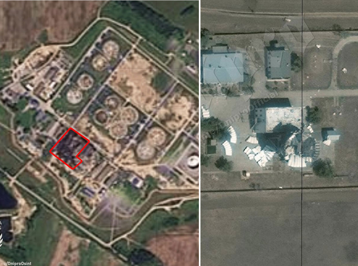
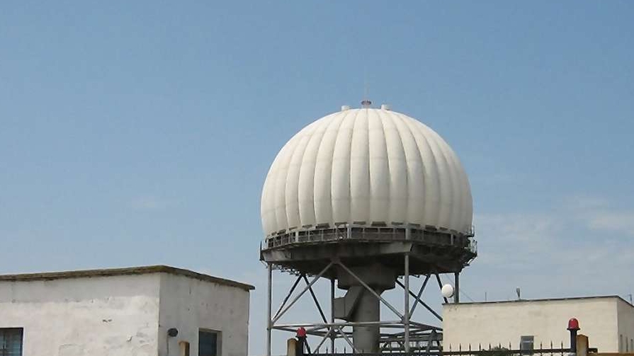
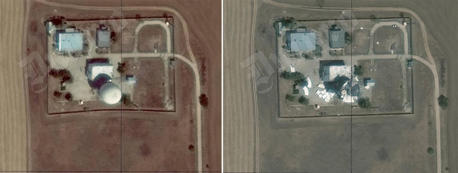
Satellite images confirm destruction of Skala-M radar in Crimea
Dnipro Osint also released a satellite photo showing the Russian TRLK-10 Skala-M radar complex in Abrykosivka, occupied Crimea, before and after it was hit. The strike reportedly happened overnight on 9–10 August and was carried out by Ukrainian Special Operations Forces working with local resistance. The agency did not specify, what weapons were used to hit the facility.
Ukraine’s special forces slip into Crimea overnight — and erase Russia’s Skala-M radar from the map
The Skala-M is a Soviet-Russian stationary route radar system with both primary and secondary detection capabilities, used for monitoring air traffic on routes and in approach zones. Its operational range reaches 350 km, making it a key element in Russia’s air traffic control network over Crimea. The new images show the radar system visibly damaged.
Read also
-
Ukraine’s drones turn Volgograd night into firestorm — Lukoil’s biggest refinery ablaze after fuel spill ignites
-
Drones attack refineries in Sloviansk-on-Kuban and Volgograd, fire reported
-
Two Russian defense plants hit in under 24 hours — drones strike Orenburg helium site and Stavropol sapphire factory