


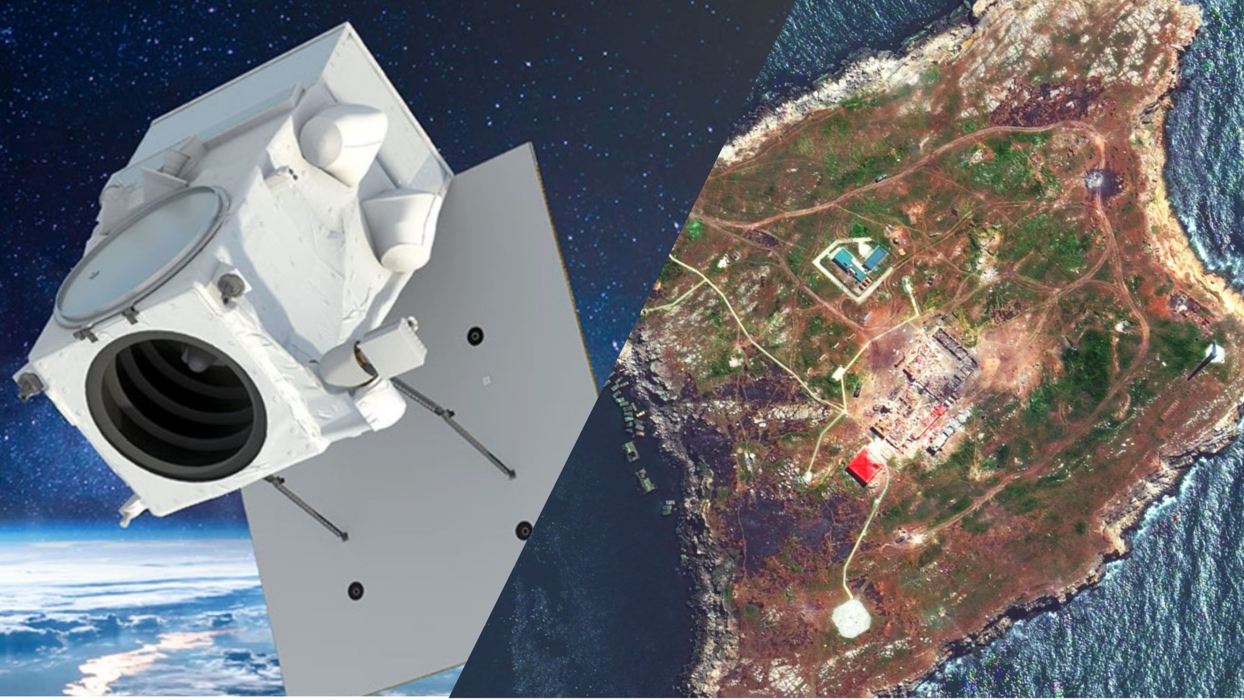
The United States has temporarily suspended Ukrainian access to commercial satellite imagery services, Maxar Technologies confirmed on 7 March, first reported by Militarnyi earlier the same day.
According to Militarnyi, Ukrainian users of Maxar’s satellite imagery service received suspension notices stating their accounts were blocked “due to an administrative request.” Users were instructed to reset their passwords to regain access.
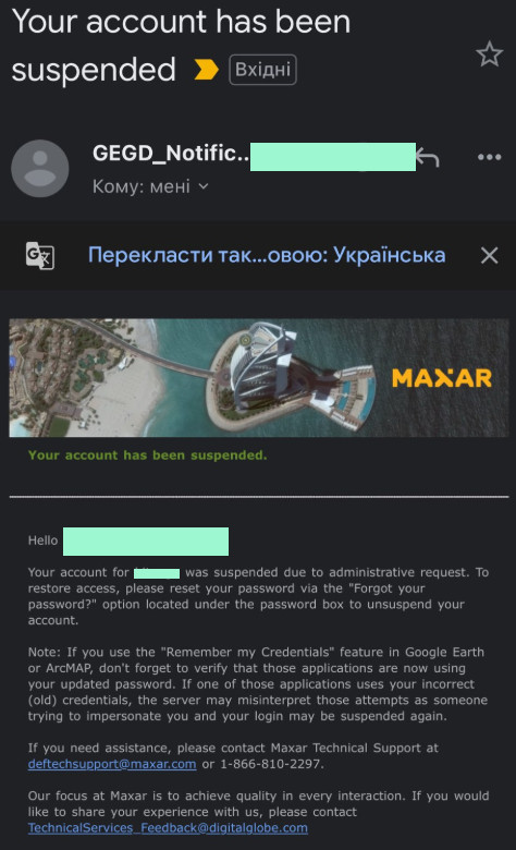
In an official statement posted on X, Maxar Technologies acknowledged the suspension:
“The US government has temporarily suspended Ukrainian accounts in GEGD (the Global Enhanced GEOINT Delivery program), a US government program that provides access to commercial satellite imagery that has been tasked and collected by the US government.”
The National Geospatial-Intelligence Agency confirmed they had “temporarily suspended access” to the system “in accordance with the administration’s directive on support to Ukraine,” as reported by The Washington Post. US officials indicated the suspension affected multiple companies that deliver imagery through the program.
Impact on battlefield operations
The suspension has already impacted Ukrainian military operations. Soldiers report that battle software integrating satellite imagery is no longer usable, limiting their battlefield awareness.
Oleksandr, a 40-year-old officer overseeing intelligence operations inside Russia’s Kursk Oblast, told WP:
“A more detailed understanding of the battlefield terrain is a huge advantage at every level. Without such data, we will inevitably lose some speed and accuracy. It’s not decisive, but it’s definitely an inconvenience.”
Near the eastern Ukrainian city of Pokrovsk, a key logistics hub relentlessly targeted by the Russian forces for months, a soldier speaking on condition of anonymity told WP that the satellite service “simply disappeared.” However, he added:
“Is this a tragedy? No, we use our own plans.”
Ukrainian forces have heavily relied on these satellite services to gain technological edge against Russian forces. Artillery and drone units use the images to assess targets and review damage to refine attacks. The imagery helps commanders track enemy positions and troop movements, while logistics personnel use it to plan vehicle routes through contested areas.
Related:
- Frontline report: Russian logistics network collapses under Ukrainian drone campaign near Pokrovsk
- NATO chief voices cautious optimism on US-Ukraine discussions
- Five resolutions supporting Ukraine fail in US Senate
- Trump claims Ukraine “more difficult” to negotiate with than Russia after he cut US aid
- ISW: Halting US intel sharing to weaken Ukraine’s defense against Russian airstrikes
- The Guardian: UK and France pledge continued intelligence support to Ukraine despite US cutoff
- Ukraine loses access to vital Maxar satellite imagery, reports Militarnyi