Powerful winter storm set to wallop eastern half of the US
By Mary Gilbert and Elizabeth Wolfe, CNN
Updated 2:26 a.m. ET, January 12, 2024
6 Posts
Sort by
1 min ago
If your area is experiencing dangerous winter conditions, here's how to stay safe
From CNN's Jacqueline Howard
A powerful storm is set to unleash blizzard conditions, severe thunderstorms, damaging winds and brutal cold across the eastern half of the US in what will be a dangerous dose of déjà vu for many.
When staying indoors during cold temperatures or a winter storm, the US Centers for Disease Control and Prevention offers these tips:
Make sure any infants younger than 1 year old are not sleeping in cold rooms and have adequate warm clothing, such as footed pajamas, one-piece wearable blankets or sleep sacks. Remove any pillows or other soft bedding from a baby’s crib, since they pose the risk of smothering or sudden infant death syndrome.
If you have friends or neighbors older than 65, check on them frequently to ensure that their homes are adequately heated.
Leave water taps slightly open to prevent freezing pipes.
Eat well-balanced meals to stay warm.
Avoid alcohol and caffeine, because they can cause your body to lose heat more rapidly.
And if you must go outside, the CDC and National Weather Service have some recommendations for staying safe while venturing outdoors during a winter storm,
Dress warmly with hats, scarves and mittens and by wearing layers.
Avoid walking on ice and avoid getting wet.
If you have to shovel snow or do other outdoor work, take your time and work slowly. If you have older neighbors, offer to help shovel their walkways or driveways.
Avoid traveling on ice-covered roads if possible.
If you are stranded outdoors, it is safest to stay in your vehicle.
Try to keep pets indoors during cold weather, but if they go outside, thoroughly wipe their legs and underbelly free of snow when returning indoors. Never let your dog off leash on snow or ice.
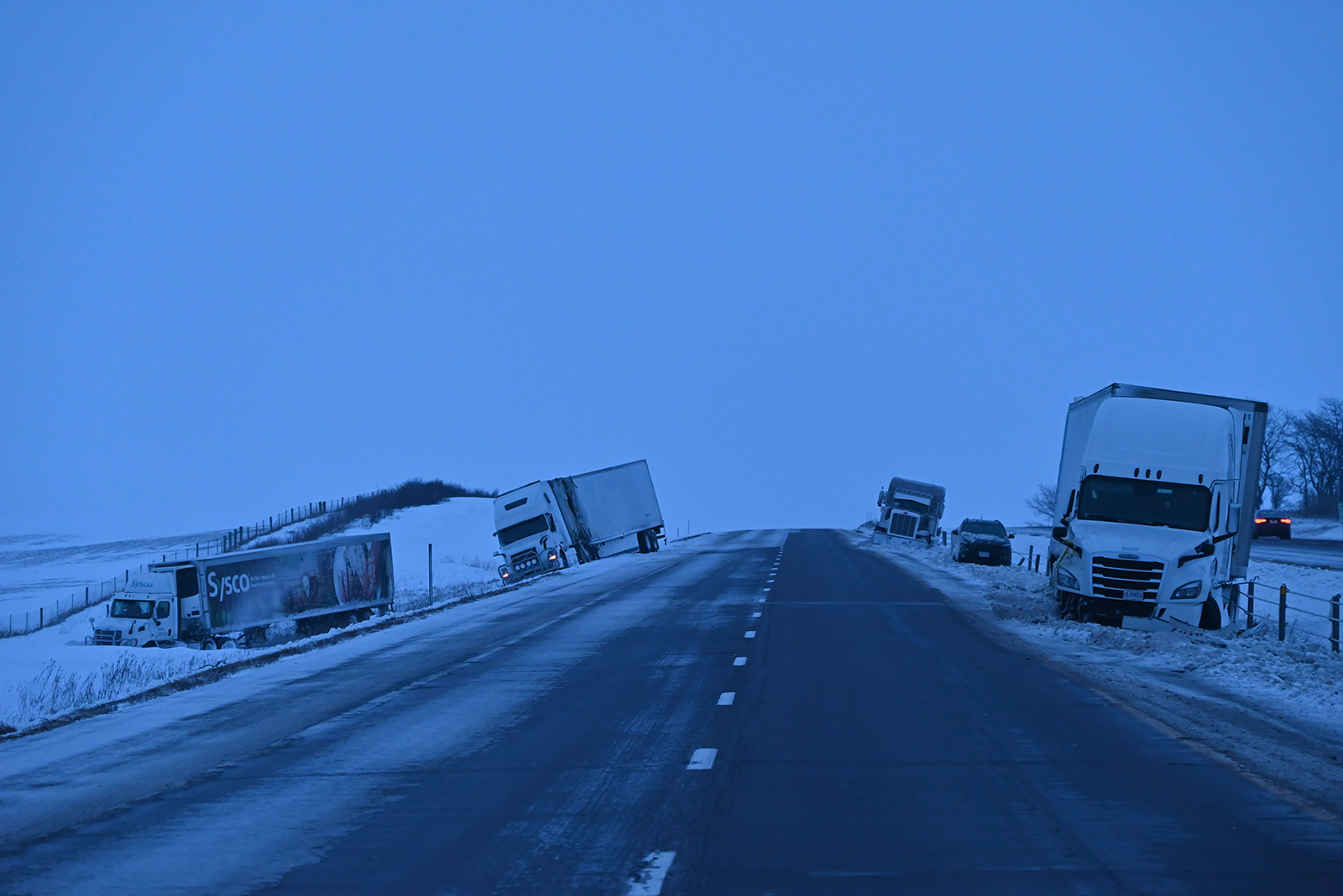
Vehicle are seen after a collision on Interstate 80 in Newton, Iowa, on Wednesday. Kyle Mazza/NurPhoto/AP
Iowa is one of the states where blizzard conditions are expected Friday -- and blizzard warnings will soon cover a majority of the Hawkeye State.
Pelting snow and winds are expected to create whiteout conditions and heavy snow accumulations. Widespread snowfall totals of 6 to 11 inches are expected in the state.
The warnings are set to be in place from 10 a.m. Friday to 6 a.m. Saturday CT and include the cities of Des Moines, Davenport, Waterloo, Ames, Sioux City and Cedar Rapids.
“Storms of this magnitude are fairly rare with recurrence around once or twice per decade,” the National Weather Service in Des Moines said. “Travel is not recommended except if absolutely necessary, especially by Friday afternoon into the evening.”
1 hr 2 min ago
Why nighttime tornadoes are so deadly
From CNN Meteorologist Mary Gilbert
Severe thunderstorms that may produce dangerous tornadoes will threaten parts of the South overnight and into the daylight hours Friday morning.
Researchers found that nighttime tornadoes from 1950 to 2019 made up less than a third of tornadoes, but were responsible for a staggering 42% of tornado deaths.
Tornado fatalities during the daytime hours have decreased by 20% since the late 1800s because of advances in science and communication, the study found. But the amount of nighttime tornado fatalities actually increased by 20% during the same period.
The increase could be due to factors like location and home construction, but the researchers said the most obvious issue is a large portion of the population is asleep at night and may miss life-saving warnings.
It’s difficult to spot a tornado at night, even for those who are awake or are awoken by warnings.
The best way to stay safe during a nocturnal tornado threat is to have multiple ways to receive severe weather warnings. At the very least, make sure emergency alerts are enabled on your smartphone. Charge devices ahead of time and set phones or alarms on a loud volume so you're not caught unaware.
1 hr 15 min ago
A record-warm Lake Michigan will fuel dramatic snowfall differences across the Chicago area
From CNN Meteorologist Mary Gilbert
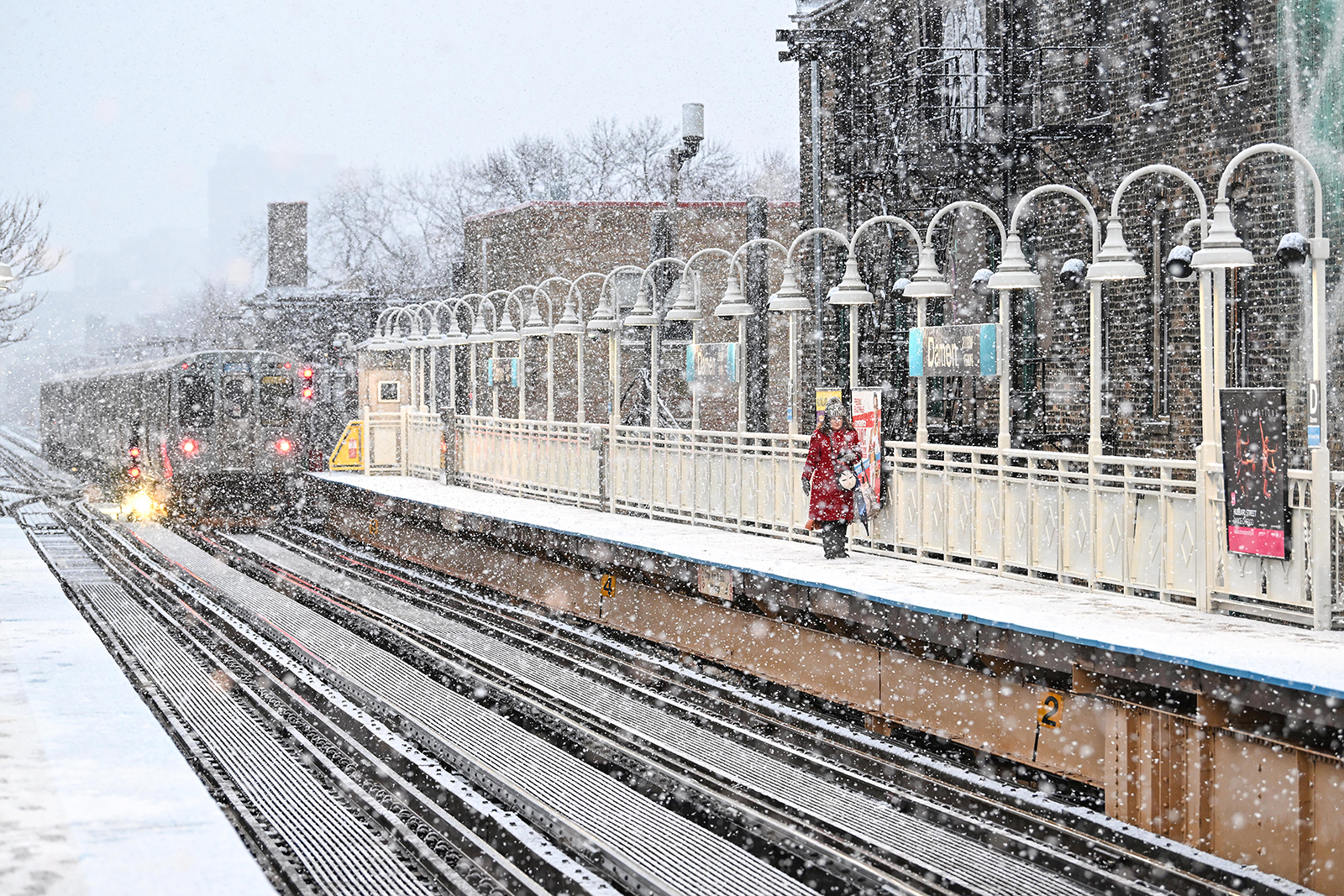
A commuter walks on the platform at the CTA Damen Blue Line station as it snows in Chicago on Tuesday. Joshua Lott/The Washington Post/Getty Images
Significant snow is on the way for the greater Chicago area, but totals will vary wildly from an inch or two to closer to double-digits depending on where you are.
“We are expecting a tight gradient in snow across a few miles inland from Lake Michigan,” Brett Borchardt, a meteorologist with the National Weather Service in Chicago, told CNN.
Meaning parts of Chicago close to the lakeshore are likely going to end up with significantly lower snowfall totals than those in the western suburbs Friday through Saturday.
This difference is tied back to the warmth of Lake Michigan, according to Borchardt.
Water temperatures on the surface of Lake Michigan are currently higher than they’ve been since records began in 1995, according to data from NOAA. Because of this warmth, the total percentage of the lake covered in ice is hovering near-zero. At this point in January, at least 10% to 20% of Lake Michigan should be covered in ice.
With warm waters and almost no ice, air temperatures near the lakeshore become warmer than typical. When air temperatures hover at or just above freezing, snow is unable to accumulate easily, lowering totals.
Snow will accumulate more readily in areas farther from Lake Michigan where air temperatures are able to drop below freezing.
"It's best to prepare for difficult travel conditions regardless of how much snow falls, especially Friday night as winds pick up and lead to areas of blowing snow including in Chicago,” Borchardt cautioned.
22 min ago
Severe thunderstorms are possible on the warmer, southern side of the storm
From CNN Meteorologist Mary Gilbert
While the northern side of the storm will deliver snowy and windy conditions, severe thunderstorms are possible Friday on the southern side -- including for a significant portion of the South and portions of the mid-Atlantic.
Early Friday, before sunrise: Parts of Arkansas, eastern Texas and northwestern Louisiana, including Shreveport, have an enhanced risk of severe storms, or a Level 3 of 5, according to the Storm Prediction Center.
A slight risk for severe storms, or Level 2 of 5, exists early Friday for a wider area, from eastern Texas to western Mississippi. The main threats there are tornadoes, strong gusts and large hail.
Friday, during the day: An enhanced risk of severe storms, or a Level 3 of 5, exists for a large portion of northern Mississippi and part of western Alabama, according to the Storm Prediction Center. A slight risk for severe storms, of Level 2 of 5, exists for a wider portion of the Southeast from the rest of Mississippi to much of the Carolinas, including the areas of Birmingham, Alabama; Memphis, Tennessee; and Charlotte and Raleigh, North Carolina.
1 hr 25 min ago
Blizzard conditions are likely on the northern side of the storm. Here's what to expect
From CNN Meteorologist Mary Gilbert
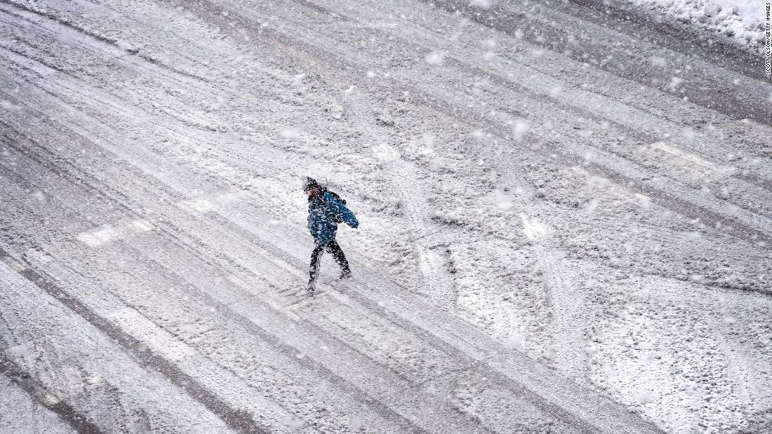
A pedestrian walks in the streets of downtown Des Moines, Iowa, during a snow squall on Wednesday. Anna Moneymaker/Getty Images
Snow will once again bury portions of the Midwest as a powerful storm tracks through the region Friday and Saturday.
The combination of heavy snow and strong winds could make travel dangerous and even impossible in some areas, especially late Friday through Friday night.
Whiteout conditions are possible from Iowa to Michigan, and people may even find themselves stuck in a blizzard.
Snowstorms are not considered blizzards until they meet certain criteria.
Blizzards occur when snow and sustained winds of 35 mph or greater combine for at least three hours and reduce visibility to a quarter-mile or less, according to the National Weather Service. More simply: strong winds blow so much snow around that it’s impossible to see a distance farther than a few football fieldsfor a long period of time.
Visibility can plummet to near-zero, meaning it’s impossible to see farther than a few feet, in the most intense blizzards.
But remember: A storm doesn't need to meet the technical definition of a blizzard in order to cause life-threatening conditions.
Storms with similar wind speeds and snow amounts that happen on short timescales are also very dangerous. Whiteout conditions for any length of time may lead to serious accidents and deadly crashes.
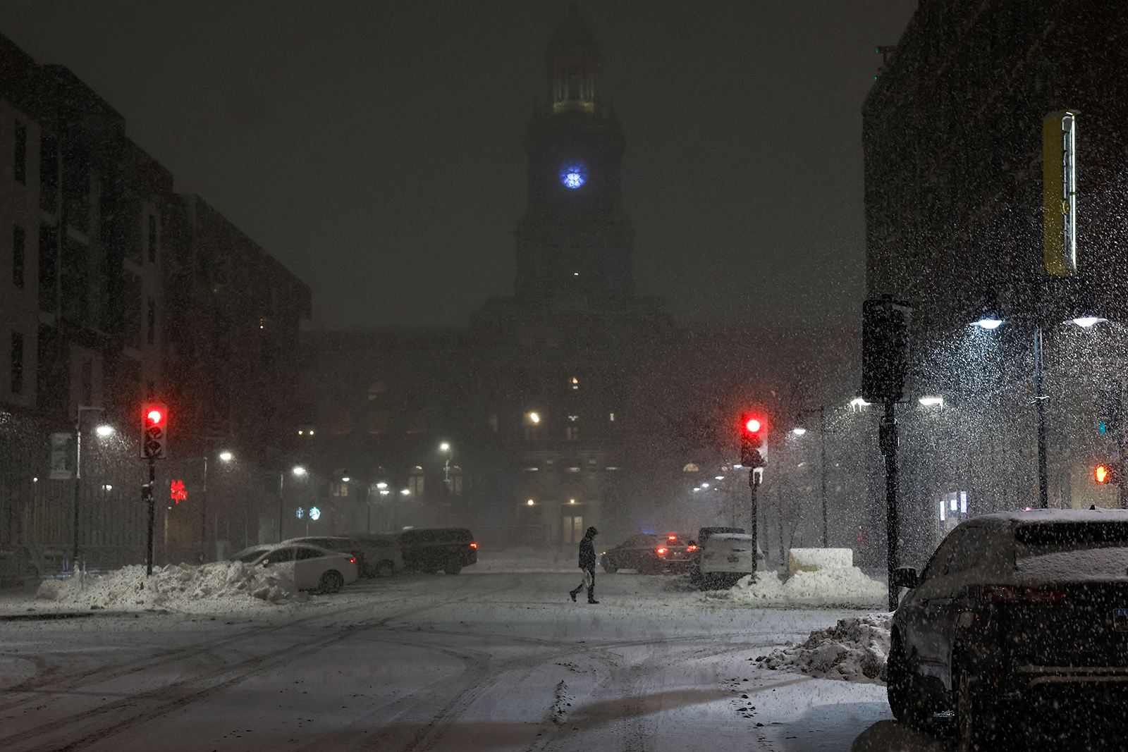
Massive storm hits the US: A powerful storm is set to unleash blizzard conditions, severe thunderstorms, damaging winds and brutal cold across the eastern half of the US.
Winter weather déjà vu: The new storm mirrors the path and hazards of the massive storm that slammed much of the country earlier this week. Thousands of people are still without power in the eastern US from the week's earlier system.
What to expect: The storm, which exited the Plains on Thursday, will move east on Friday and continue to become stronger, enveloping more of the Midwest with snow. On the southern, warm side of the storm, another significant severe thunderstorm event will target a large section of the Southeast and portions of the mid-Atlantic.
Arctic blast: A brutal blast of Arctic air will spread through the central US on the heels of this storm, starting Friday night in the northern Plains, where temperatures could drop as low as 30 degrees below zero. It will spread south and east by the weekend and last into the middle of next week.
A powerful storm is set to unleash blizzard conditions, severe thunderstorms, damaging winds and brutal cold across the eastern half of the US in what will be a dangerous dose of déjà vu for many.
When staying indoors during cold temperatures or a winter storm, the US Centers for Disease Control and Prevention offers these tips:
Make sure any infants younger than 1 year old are not sleeping in cold rooms and have adequate warm clothing, such as footed pajamas, one-piece wearable blankets or sleep sacks. Remove any pillows or other soft bedding from a baby’s crib, since they pose the risk of smothering or sudden infant death syndrome.
If you have friends or neighbors older than 65, check on them frequently to ensure that their homes are adequately heated.
Leave water taps slightly open to prevent freezing pipes.
Eat well-balanced meals to stay warm.
Avoid alcohol and caffeine, because they can cause your body to lose heat more rapidly.
And if you must go outside, the CDC and National Weather Service have some recommendations for staying safe while venturing outdoors during a winter storm,
Dress warmly with hats, scarves and mittens and by wearing layers.
Avoid walking on ice and avoid getting wet.
If you have to shovel snow or do other outdoor work, take your time and work slowly. If you have older neighbors, offer to help shovel their walkways or driveways.
Avoid traveling on ice-covered roads if possible.
If you are stranded outdoors, it is safest to stay in your vehicle.
Try to keep pets indoors during cold weather, but if they go outside, thoroughly wipe their legs and underbelly free of snow when returning indoors. Never let your dog off leash on snow or ice.
Vehicle are seen after a collision on Interstate 80 in Newton, Iowa, on Wednesday. Kyle Mazza/NurPhoto/AP
Iowa is one of the states where blizzard conditions are expected Friday -- and blizzard warnings will soon cover a majority of the Hawkeye State.
Pelting snow and winds are expected to create whiteout conditions and heavy snow accumulations. Widespread snowfall totals of 6 to 11 inches are expected in the state.
The warnings are set to be in place from 10 a.m. Friday to 6 a.m. Saturday CT and include the cities of Des Moines, Davenport, Waterloo, Ames, Sioux City and Cedar Rapids.
“Storms of this magnitude are fairly rare with recurrence around once or twice per decade,” the National Weather Service in Des Moines said. “Travel is not recommended except if absolutely necessary, especially by Friday afternoon into the evening.”
Severe thunderstorms that may produce dangerous tornadoes will threaten parts of the South overnight and into the daylight hours Friday morning.
Researchers found that nighttime tornadoes from 1950 to 2019 made up less than a third of tornadoes, but were responsible for a staggering 42% of tornado deaths.
Tornado fatalities during the daytime hours have decreased by 20% since the late 1800s because of advances in science and communication, the study found. But the amount of nighttime tornado fatalities actually increased by 20% during the same period.
The increase could be due to factors like location and home construction, but the researchers said the most obvious issue is a large portion of the population is asleep at night and may miss life-saving warnings.
It’s difficult to spot a tornado at night, even for those who are awake or are awoken by warnings.
The best way to stay safe during a nocturnal tornado threat is to have multiple ways to receive severe weather warnings. At the very least, make sure emergency alerts are enabled on your smartphone. Charge devices ahead of time and set phones or alarms on a loud volume so you're not caught unaware.
A commuter walks on the platform at the CTA Damen Blue Line station as it snows in Chicago on Tuesday. Joshua Lott/The Washington Post/Getty Images
Significant snow is on the way for the greater Chicago area, but totals will vary wildly from an inch or two to closer to double-digits depending on where you are.
“We are expecting a tight gradient in snow across a few miles inland from Lake Michigan,” Brett Borchardt, a meteorologist with the National Weather Service in Chicago, told CNN.
Meaning parts of Chicago close to the lakeshore are likely going to end up with significantly lower snowfall totals than those in the western suburbs Friday through Saturday.
This difference is tied back to the warmth of Lake Michigan, according to Borchardt.
Water temperatures on the surface of Lake Michigan are currently higher than they’ve been since records began in 1995, according to data from NOAA. Because of this warmth, the total percentage of the lake covered in ice is hovering near-zero. At this point in January, at least 10% to 20% of Lake Michigan should be covered in ice.
With warm waters and almost no ice, air temperatures near the lakeshore become warmer than typical. When air temperatures hover at or just above freezing, snow is unable to accumulate easily, lowering totals.
Snow will accumulate more readily in areas farther from Lake Michigan where air temperatures are able to drop below freezing.
"It's best to prepare for difficult travel conditions regardless of how much snow falls, especially Friday night as winds pick up and lead to areas of blowing snow including in Chicago,” Borchardt cautioned.
While the northern side of the storm will deliver snowy and windy conditions, severe thunderstorms are possible Friday on the southern side -- including for a significant portion of the South and portions of the mid-Atlantic.
Early Friday, before sunrise: Parts of Arkansas, eastern Texas and northwestern Louisiana, including Shreveport, have an enhanced risk of severe storms, or a Level 3 of 5, according to the Storm Prediction Center.
A slight risk for severe storms, or Level 2 of 5, exists early Friday for a wider area, from eastern Texas to western Mississippi. The main threats there are tornadoes, strong gusts and large hail.
Friday, during the day: An enhanced risk of severe storms, or a Level 3 of 5, exists for a large portion of northern Mississippi and part of western Alabama, according to the Storm Prediction Center. A slight risk for severe storms, of Level 2 of 5, exists for a wider portion of the Southeast from the rest of Mississippi to much of the Carolinas, including the areas of Birmingham, Alabama; Memphis, Tennessee; and Charlotte and Raleigh, North Carolina.
A pedestrian walks in the streets of downtown Des Moines, Iowa, during a snow squall on Wednesday. Anna Moneymaker/Getty Images
Snow will once again bury portions of the Midwest as a powerful storm tracks through the region Friday and Saturday.
The combination of heavy snow and strong winds could make travel dangerous and even impossible in some areas, especially late Friday through Friday night.
Whiteout conditions are possible from Iowa to Michigan, and people may even find themselves stuck in a blizzard.
Snowstorms are not considered blizzards until they meet certain criteria.
Blizzards occur when snow and sustained winds of 35 mph or greater combine for at least three hours and reduce visibility to a quarter-mile or less, according to the National Weather Service. More simply: strong winds blow so much snow around that it’s impossible to see a distance farther than a few football fieldsfor a long period of time.
Visibility can plummet to near-zero, meaning it’s impossible to see farther than a few feet, in the most intense blizzards.
But remember: A storm doesn't need to meet the technical definition of a blizzard in order to cause life-threatening conditions.
Storms with similar wind speeds and snow amounts that happen on short timescales are also very dangerous. Whiteout conditions for any length of time may lead to serious accidents and deadly crashes.