

Tropical Storm Imelda formed in the Atlantic Ocean on Sunday and could affect the southeast U.S. coastline in the coming week.
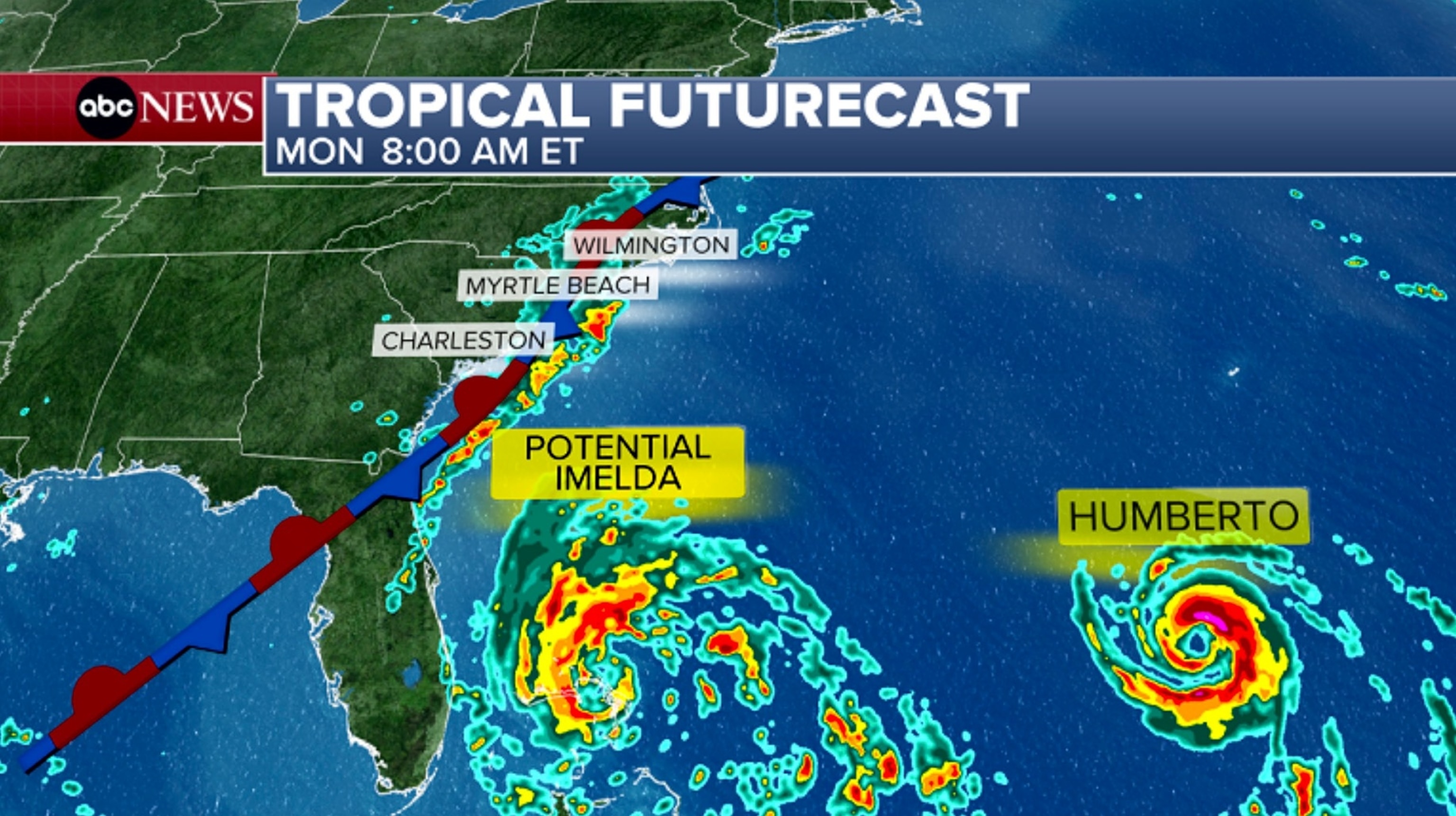
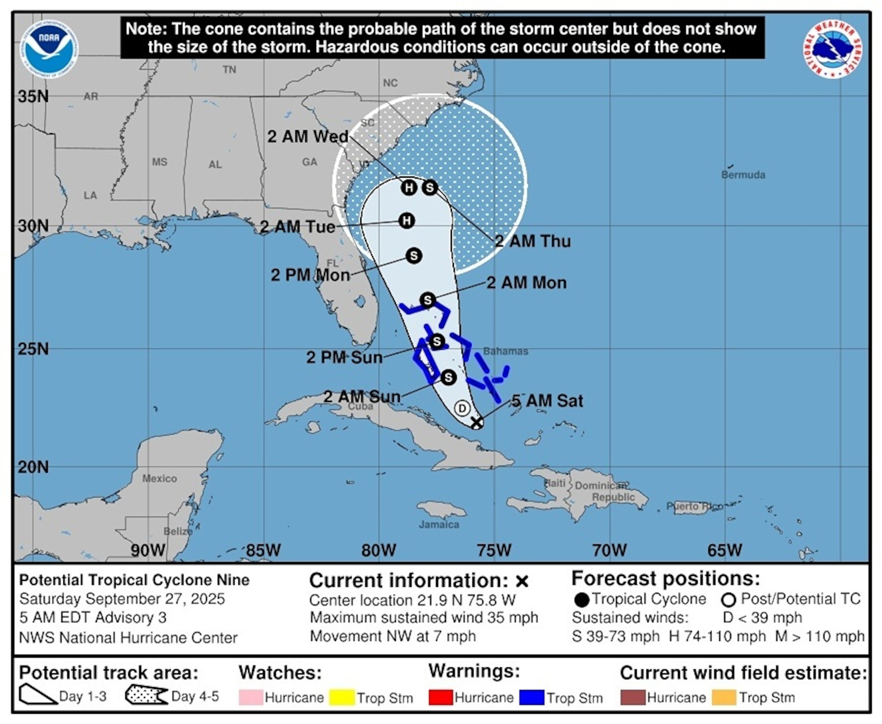
After becoming the ninth named storm of the Atlantic hurricane season on Sunday, Tropical Storm Imelda continues to maintain its strength over the southwest Atlantic. It will continue to track northward over the Bahamas into Monday, where it is bringing tropical storm conditions.
As of 11 p.m., Imelda was centered about 320 miles southeast of Cape Canaveral, Florida, producing maximum sustained wind speeds of 40 mph and higher gusts.
A gust of 47 mph was recorded on Blue Lagoon Island, just northeast of Nassau, Bahamas.
Both North and South Carolina declared states of emergency ahead of the forecasted hazardous weather.
"North Carolinians across the state should prepare for tropical weather to bring heavy rainfall and potential flooding," said Gov. Josh Stein in a statement Sunday.
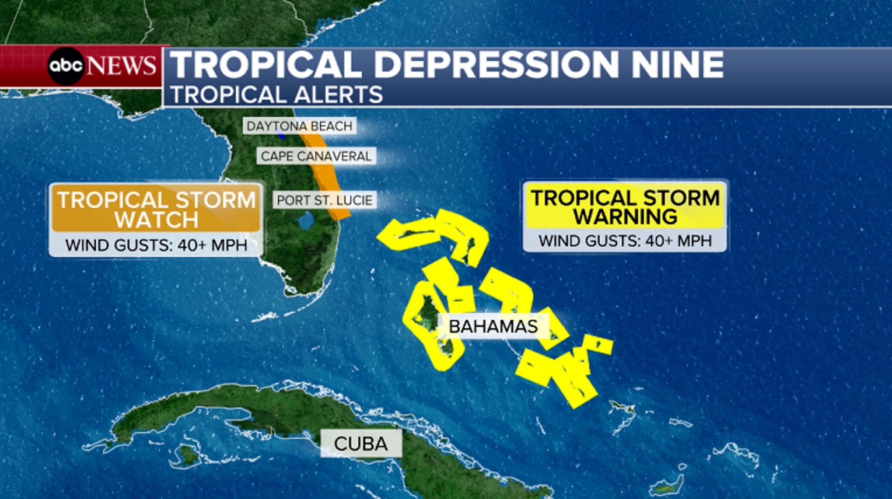
For now, a tropical storm watch has been issued for the east coast of central Florida. A tropical storm warning continues for most of the Bahamas.
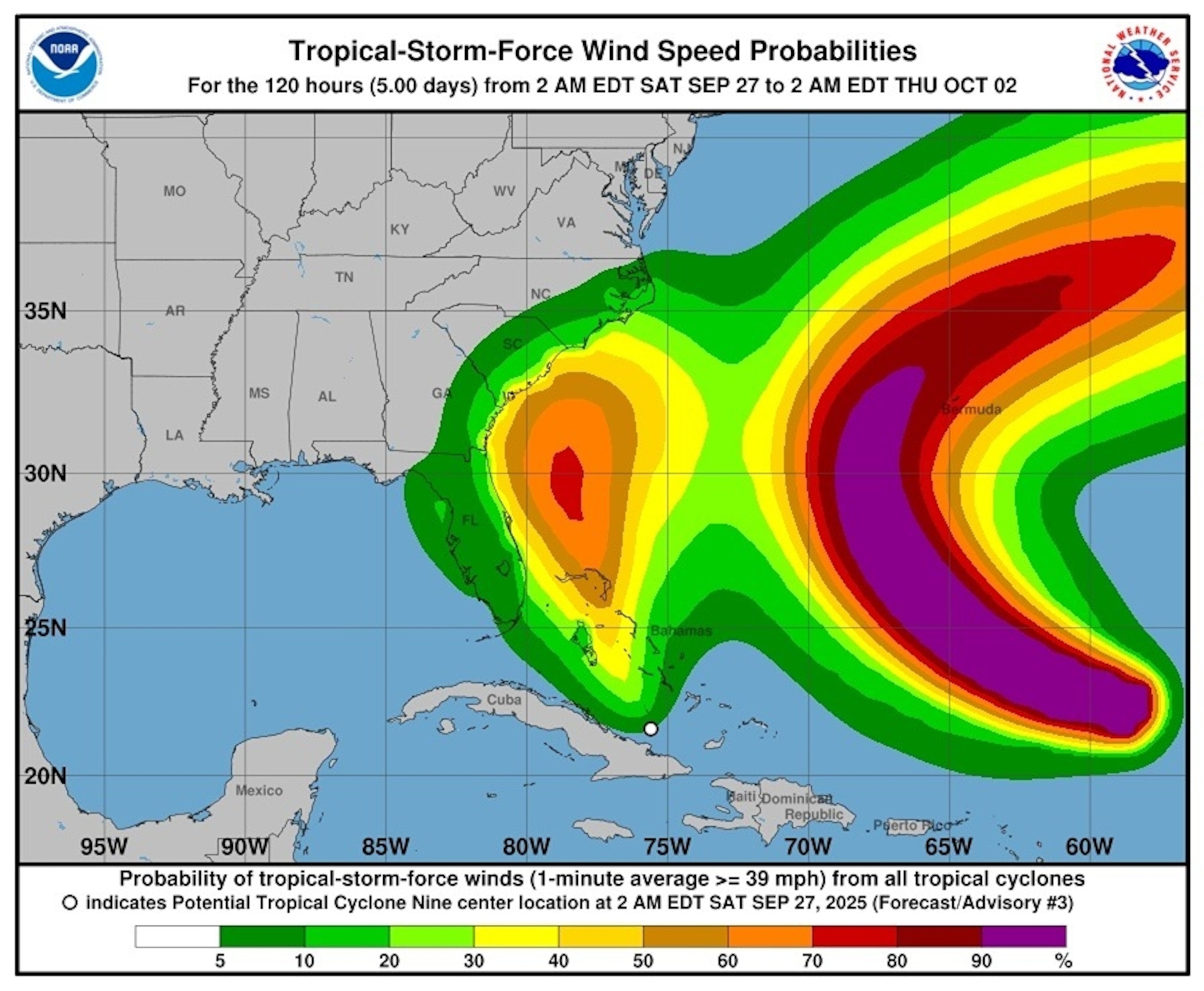
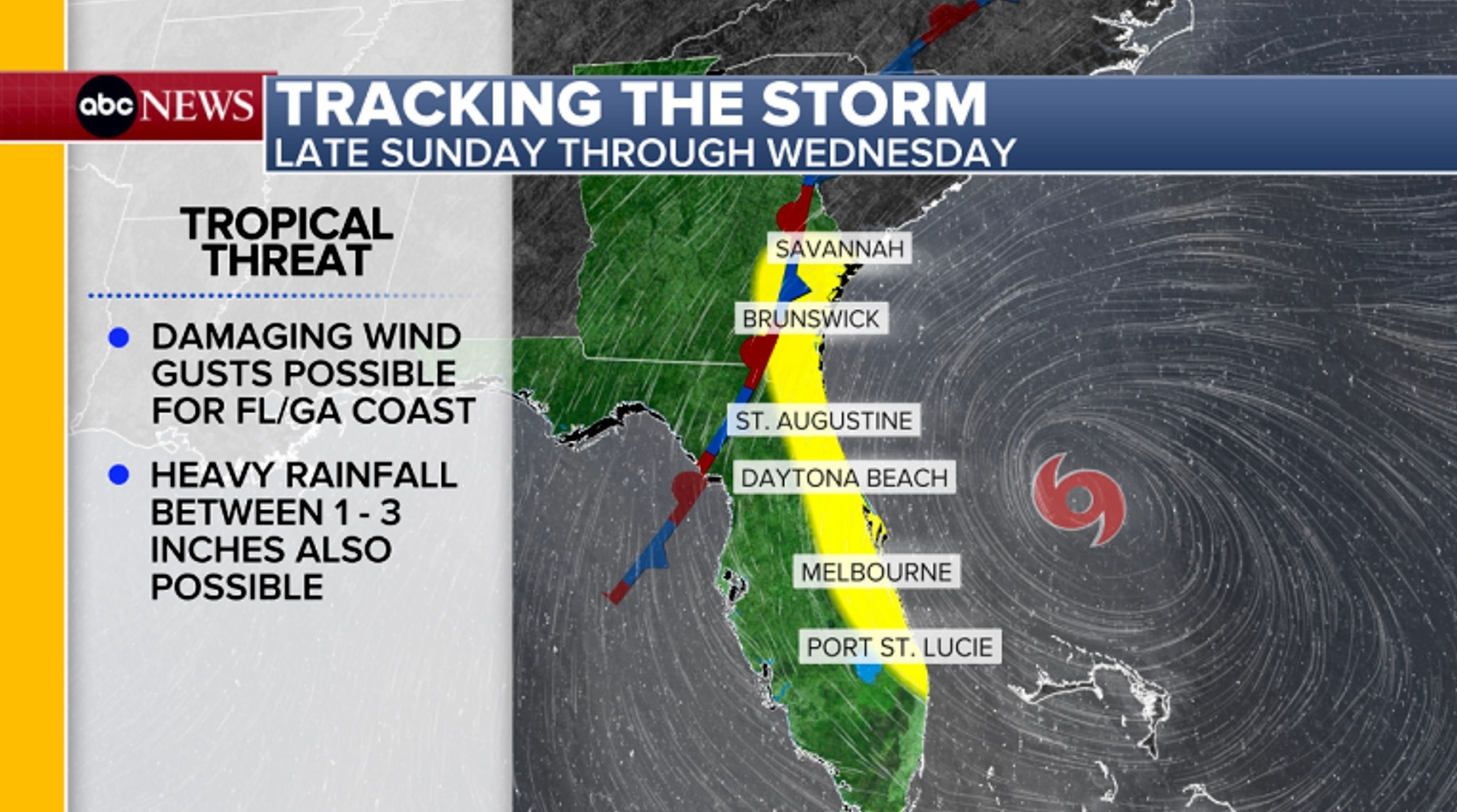
On Sunday through Monday, Imelda will track north through the Bahamas and parallel to the east coast of Florida, where it will batter the Bahamas with heavy rain and tropical-storm-force winds.
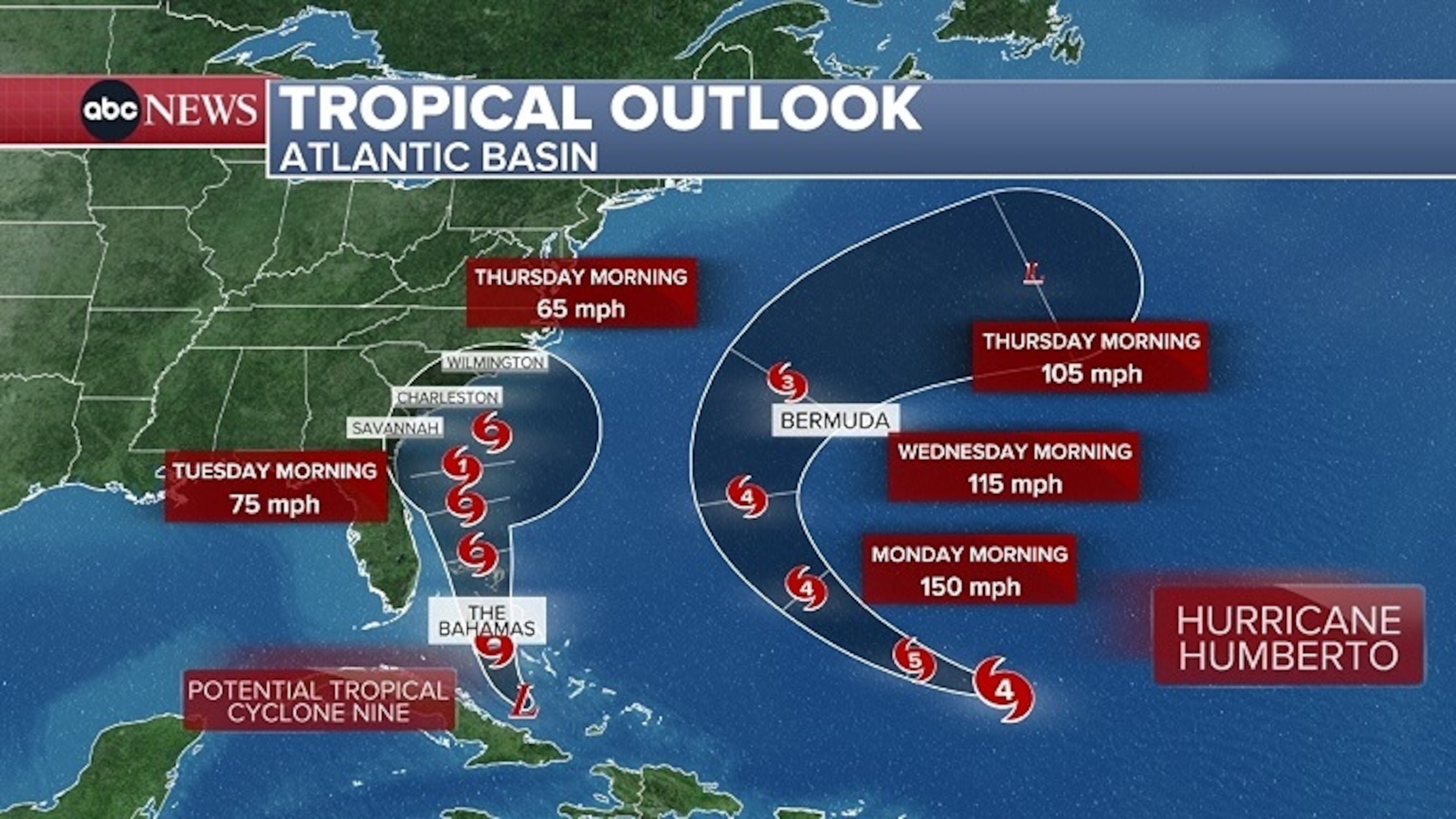
While there is still some uncertainty with the track because of a complex steering setup, weather models are beginning to align with the storm beginning to slow down as it approaches the coast of Georgia and South Carolina, then making a hard turn east and avoiding landfall thanks to a helping "tug" from strong Hurricane Humberto well off to the east near Bermuda.
By around Tuesday, the system will be close to the Georgia and South Carolina coasts as possibly a strong tropical storm or weak Category 1 hurricane, and this is where the heaviest rain and strongest winds will be on display for the Carolinas.
Storm surge and coastal flooding for the Carolinas and coastal Georgia will also be possible for the first half of next week.
This storm will interact with a stalled front that will be draped over the Southeast coast this weekend into next week, which will allow for multiple days of rainfall across the coast from Georgia up to Virginia.
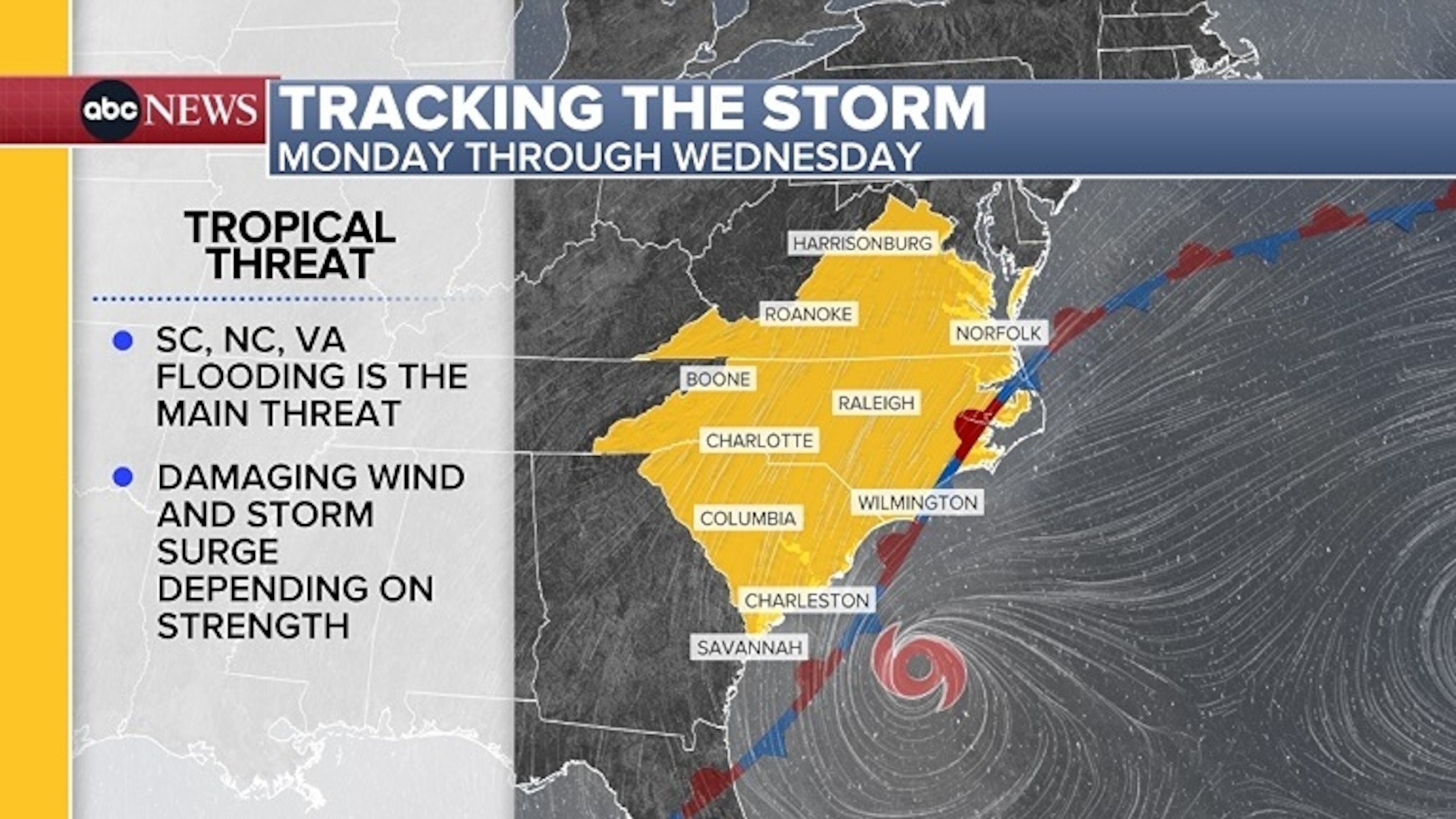
Even though a landfall is looking increasingly unlikely, the coastline all the way up to Virginia is expected to see indirect impacts. There will be some rain, moderate wind gusts and coastal flooding from a prolonged onshore flow.
South Carolina Gov. Henry McMaster declared a state of emergency Sunday but said the state has "no intention" of issuing any mandatory evacuation orders for the upcoming storm, but that people should not "be misled."
"We know that we're going to have high winds, we know that we're going to have a lot of water," the governor said.
McMaster also invoked the one-year anniversary of Hurricane Helene to compare it to the uncertainty of this storm.
"We remember that it did not go exactly where it was expected to go," he said. "This storm does not look as strong as it looked yesterday, but that could change tonight."
The governor said he is "expecting" the federal government to cooperate and Friday's emergency declaration was to get people and equipment in the right places, including helicopters and aerial resources.
"The good news is the storm will probably stay out in the ocean," McMaster said, while still cautioning people to be prepared. "Don't drive through standing water… we lose a lot of people through drowning," the governor said, calling that "pitiful."
The city of Charleston, South Carolina, also issued a local state of emergency out of an abundance of caution.
"Today's action is about readiness," said Mayor William Cogswell. "Our teams are clearing drains, staging pumps and barricades, and adjusting staffing so we can respond quickly if conditions worsen."
Meanwhile, Humberto remains a major category 4 hurricane, producing maximum sustained wind speeds of 140 mph.
It is 430 miles south-southwest of Bermuda and will continue moving toward the northwest Sunday into Monday before turning toward the northeast Tuesday into Wednesday, curving west and north of Bermuda.
Even though the center of the storm will stay well offshore with some slight fluctuations in intensity, Humberto is expected to remain a powerful and dangerous major hurricane over the next couple of days.
It is forecast to gradually weaken once it takes on a more northeasterly trajectory, but will still generate high surf and dangerous rip currents along the East Coast of the U.S. and Bermuda.
